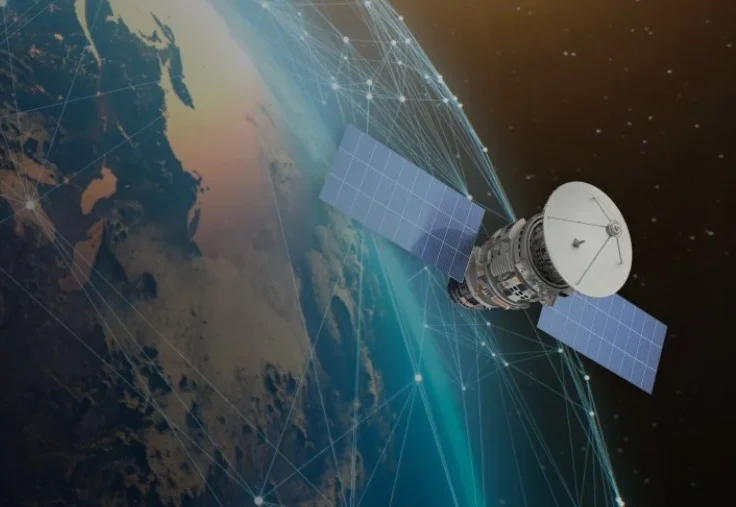
The National Aeronautics and Space Administration’s (NASA) Commercial Satellite Data Acquisition (CSDA) Program is poised to host a comprehensive webinar on September 14, 2026, offering a deep dive into its activities, advancements, and the expanding landscape of commercial Earth observation data. This pivotal event will serve as a crucial update for researchers, policymakers, commercial partners, and the broader scientific community, highlighting how the CSDA program is strategically enhancing NASA’s Earth science capabilities by integrating high-quality commercial datasets with its venerable fleet of government-owned satellites. Established as a science-enabling initiative, the CSDA program’s core mission revolves around providing licensed access to a diverse array of commercial Earth observation data, rigorously strengthening data quality through robust calibration/validation (cal/val) partnerships and transparent evaluations, and actively funding the development of innovative science and application use cases. These efforts are designed to translate raw commercial data into actionable research and practical, applied solutions, thereby accelerating our understanding of Earth’s complex systems and informing critical decision-making across various sectors.
A New Era in Earth Observation: NASA’s Strategic Embrace of Commercial Data
The CSDA program represents a significant evolution in NASA’s approach to Earth science, acknowledging the rapid advancements and growing capabilities of the private space sector. For decades, government agencies like NASA have been the primary developers and operators of Earth-observing satellites, providing invaluable, foundational datasets that are freely and openly available to the global scientific community. These "gold standard" observations from missions like Landsat, Aqua, Terra, and the Suomi NPP have formed the bedrock of climate science, environmental monitoring, and natural resource management. However, the burgeoning commercial space industry has introduced unprecedented capabilities, including constellations of small satellites capable of delivering high-resolution imagery and data with vastly increased revisit rates and tasking flexibility, often at a lower cost than bespoke government missions.
The imperative for NASA to engage with commercial providers stems from several factors. While government missions are designed for long-term, systematic data collection with stringent scientific requirements, they often face limitations in terms of spatial resolution, temporal frequency, and the ability to rapidly task for specific events. Commercial constellations, with their hundreds of satellites, can image almost any point on Earth daily, sometimes multiple times a day, and can be redirected to focus on areas of interest, such as natural disasters, agricultural fields, or dynamic coastal zones, within hours. This agility and density of data are invaluable for monitoring rapidly changing phenomena and for applications requiring near real-time information. The CSDA program effectively augments NASA’s existing public assets, filling critical gaps and providing a complementary layer of data that enhances both scientific discovery and operational applications.
The Rise of Commercial Space and Data Demand
The early 2010s saw a proliferation of private companies entering the Earth observation sector, driven by technological advancements in miniaturization, launch capabilities, and data processing. Companies like Planet Labs, Maxar Technologies, Capella Space, and ICEYE began deploying extensive constellations, offering optical, synthetic aperture radar (SAR), thermal, and even hyperspectral data. This surge created a vast new pool of Earth observation data, but its integration into scientific workflows required a structured approach. Researchers needed reliable access, standardized data formats, robust quality assurance, and clear licensing terms. The CSDA program was conceived to address these challenges, acting as a crucial bridge between the innovative capabilities of the commercial sector and the rigorous demands of scientific research and public applications. Launched in the early 2020s, the program built upon earlier pilot initiatives, formalizing NASA’s commitment to leveraging commercial data strategically.
The Core Pillars of CSDA: Acquisition, Quality, and Application
The CSDA program is structured around three foundational pillars: acquiring licensed access to diverse commercial datasets, ensuring the scientific quality and utility of this data, and fostering its application through targeted research and development.
Data Acquisition and Access
Central to CSDA is the acquisition of licensed access to high-quality commercial Earth observation data. This involves engaging with a wide array of commercial providers to procure data that meets specific scientific needs not fully addressed by NASA’s own missions. The data modalities available through the program are diverse, encompassing:
- High-Resolution Optical Imagery: Providing detailed visual information for land use mapping, urban planning, and environmental monitoring.
- Synthetic Aperture Radar (SAR) Data: Capable of penetrating clouds and operating day or night, essential for monitoring changes in land surface, ice, and ocean conditions, particularly useful in disaster response scenarios like flood mapping or oil spill detection.
- Thermal Infrared Data: Measuring heat signatures, critical for monitoring wildfires, urban heat islands, and agricultural water stress.
- Hyperspectral Data: Capturing data across hundreds of narrow spectral bands, enabling detailed analysis of vegetation health, mineral composition, and water quality.
- Atmospheric and Greenhouse Gas Monitoring: Emerging commercial capabilities to track emissions and atmospheric constituents at finer scales.
The program establishes task orders with these data providers, outlining the types and volumes of data required, as well as the technical specifications and delivery mechanisms. This process ensures that NASA scientists and partner researchers have access to the most relevant and cutting-edge commercial datasets.
Enhancing Data Quality: The Cal/Val Initiative
A paramount concern when integrating commercial data into scientific research is data quality and consistency. Unlike government missions, which undergo extensive pre-launch and on-orbit calibration and validation, commercial data products can vary significantly between providers and even within a single constellation. The CSDA program addresses this through a robust calibration/validation (cal/val) initiative. This involves collaborative partnerships with commercial data providers to perform independent evaluations, cross-comparisons with NASA’s own "gold standard" datasets, and the development of standardized metrics and protocols.
During the upcoming webinar, speakers are expected to detail updates to the evaluation process, emphasizing transparency and scientific rigor. This new cal/val initiative aims to not only assess the quality of incoming commercial data but also to actively work with providers to improve their data products. By fostering a collaborative environment, CSDA ensures that the commercial data acquired is scientifically sound and suitable for complex research applications, thereby building trust and confidence within the scientific community. The long-term goal is to enable seamless integration of commercial data into existing scientific models and analyses, treating it with the same level of confidence as traditional government data.
Fostering Innovation: Use Case Development
Beyond mere acquisition and quality assurance, the CSDA program actively funds the development of science and application use cases. This involves supporting research projects that leverage commercial data to address specific scientific questions or develop applied solutions. These use cases are crucial for demonstrating the utility and impact of commercial data, illustrating how high-resolution, high-frequency, and taskable datasets can lead to new discoveries or more effective operational tools.
Examples of such use cases include:

- Disaster Response: Rapid assessment of damage from hurricanes, earthquakes, or wildfires using high-cadence imagery to support emergency management.
- Agricultural Monitoring: Precision agriculture applications, such as monitoring crop health, irrigation needs, and yield predictions at the individual field level.
- Climate Change Research: Tracking glacier melt, sea-level rise impacts, changes in forest cover, and urban expansion with unprecedented detail.
- Water Resource Management: Monitoring water bodies, detecting algal blooms, and assessing drought impacts with frequent revisits.
- Maritime Domain Awareness: Tracking vessel movements and detecting illegal fishing or pollution events.
By funding these projects, CSDA not only validates the scientific value of commercial data but also creates a feedback loop, demonstrating to commercial providers the types of data products and services most valuable to the scientific and applications communities.
Navigating the Webinar Agenda: Key Insights for Stakeholders
The upcoming webinar promises a comprehensive overview of the CSDA program’s activities and future trajectory, structured to inform a diverse audience.
Diverse Data Modalities and Provider Engagements
A key segment will focus on the data modalities currently available through the program and updates on the status of existing task orders with CSDA data providers. Attendees can expect detailed insights into which commercial partners are actively contributing data, the types of data they offer (e.g., specific SAR bands, optical resolutions, revisit rates), and the volume of data being acquired. This will be crucial for researchers looking to identify specific datasets for their projects. The discussion will also cover the evolution of the program’s engagement with providers, reflecting ongoing efforts to broaden the scope of data acquisition and integrate new technologies as they emerge from the commercial sector. This might include, for instance, initial assessments of novel sensor types or new satellite constellations that have recently become operational.
Streamlined Access and Enhanced Capabilities: The Satellite Data Explorer
A significant highlight of the webinar will be the unveiling or update on new data archive and tasking capabilities available through the "Satellite Data Explorer." This platform is designed to be the primary gateway for users to discover, access, and potentially task commercial satellite data through the CSDA program. Presenters will walk attendees through its functionalities, demonstrating how users can search for available datasets based on criteria such as geographic area, time range, sensor type, and resolution. The explorer is expected to feature intuitive interfaces for browsing archived data and, critically, for submitting requests for new tasking of commercial satellites over specific areas of interest, subject to program guidelines and provider capabilities. This represents a major step towards democratizing access to these powerful commercial assets for the scientific community, ensuring that researchers can efficiently locate and utilize the data relevant to their studies.
Licensing, Engagement, and Learning Resources
Understanding the types of end-user licensing agreements is paramount for researchers, as commercial data often comes with more restrictive terms than NASA’s freely available public data. The webinar will clarify these agreements, explaining the permissible uses, data sharing protocols, and any restrictions, ensuring that users can confidently and compliantly integrate commercial data into their work. Furthermore, presenters will outline various user engagement opportunities, such as workshops, user forums, and technical support channels, designed to build a strong community around the CSDA program. Finally, new learning resources, including tutorials, documentation, and best practice guides, will be introduced. These resources are essential for helping new users navigate the complexities of commercial data, from data discovery and access to processing and analysis, thereby lowering the barrier to entry for leveraging these valuable datasets.
Strategic Rationale and Broader Implications
The CSDA program is more than just a data acquisition initiative; it is a strategic investment by NASA into the future of Earth science, with far-reaching implications across scientific, economic, and societal domains.
Economic Catalyst and Technological Advancement
By actively engaging with the commercial space industry, NASA acts as a significant customer, providing stable revenue streams and fostering innovation. This partnership helps commercial providers refine their technologies, expand their constellations, and develop new services, thereby stimulating economic growth within the sector. The program’s emphasis on cal/val partnerships also drives commercial providers to meet higher data quality standards, pushing the entire industry towards greater scientific rigor and interoperability. This symbiotic relationship ensures that NASA benefits from cutting-edge commercial capabilities, while the commercial sector gains validation and market opportunities.
Addressing Global Challenges
The high-resolution, high-frequency data acquired through CSDA has profound implications for addressing some of the most pressing global challenges. Enhanced monitoring of climate change indicators, more precise agricultural management for food security, rapid response to natural disasters, and improved environmental protection all stand to benefit immensely. For instance, detailed, daily imagery can help track the rapid retreat of glaciers, monitor illegal deforestation in protected areas, or provide granular data for assessing flood damage and guiding humanitarian aid efforts with unprecedented speed and accuracy. This capacity for timely, detailed observation empowers scientists and policymakers to make more informed decisions in a world grappling with complex environmental and societal issues.
Future Trajectory and Potential Challenges
Looking ahead, the CSDA program is expected to expand its scope, incorporating even more diverse data types and integrating emerging commercial capabilities. This could include data from novel sensor technologies, improved analytics services offered by commercial entities, and even deeper integration of artificial intelligence and machine learning for automated feature detection and data interpretation.
However, challenges remain. These include ensuring long-term funding stability, managing the complexities of diverse licensing agreements across multiple providers, and integrating petabytes of heterogeneous commercial data with existing government archives. Data interoperability and standardization will continue to be critical areas of focus to maximize the utility of these varied datasets. Furthermore, maintaining the balance between proprietary commercial interests and the scientific community’s need for open access and data sharing will be an ongoing dialogue. The CSDA program’s success hinges on its ability to navigate these complexities while continuously demonstrating the tangible scientific and societal benefits of its commercial partnerships.
The upcoming webinar on September 14, 2026, therefore, is not merely a program update; it is a testament to NASA’s visionary strategy in embracing the dynamism of the commercial space sector. It underscores a fundamental shift in how Earth science data is acquired, validated, and utilized, propelling forward our collective ability to understand, monitor, and protect our planet for generations to come. The insights shared will be invaluable for shaping the future direction of Earth observation, fostering collaboration, and accelerating the pace of scientific discovery and applied solutions globally.