Three hikers were successfully rescued from the treacherous slopes of California’s Mount Shasta this week, an incident that has drawn significant attention to the potential pitfalls of relying solely on artificial intelligence for critical expedition planning. The trio, whose ambitious ascent went awry, had reportedly used Google’s AI chatbot, Gemini, to map out their journey, leading to a severe underestimation of necessary provisions and the inherent dangers of the 14,179-foot peak. The rescue, detailed in a report from the Siskiyou County Sheriff’s Office and subsequently reported by outlets including the Chicago Tribune, serves as a stark reminder of the indispensable role of human judgment, local expertise, and robust preparedness in high-stakes outdoor adventures.
A Detailed Chronology of the Ill-Fated Expedition
The incident began in the early hours of what was intended to be a single-day ascent. At approximately 3:00 AM, the three young men commenced their climb up Mount Shasta, a formidable stratovolcano known for its challenging terrain, rapidly changing weather conditions, and significant elevation gain. Their plan, formulated with assistance from Google Gemini, reportedly suggested an eight-hour ascent, a timeline that vastly underestimated the realities of climbing such a peak, particularly for potentially inexperienced hikers.
As the day progressed, it became evident that the AI-generated timeline was profoundly unrealistic. While standard mountaineering wisdom on Mount Shasta dictates that climbers should turn around by noon if they have not reached the summit to allow for a safe daylight descent, the trio pressed on. It was not until 7:00 PM, well after sunset and nine hours beyond the recommended turnaround time, that the hikers finally reached the summit. By this point, exhaustion, the onset of darkness, and dwindling supplies had significantly compromised their ability to navigate safely.
With visibility severely limited and the temperature dropping precipitously, the hikers attempted to descend in the dark. Their efforts quickly proved futile, and they soon found themselves disoriented and lost. Realizing the gravity of their situation, they made the prudent decision to contact the Siskiyou County Sheriff’s Office, seeking directions and assistance. Given the extreme conditions and the hazards of a nighttime rescue on the mountain, the decision was made for the hikers to shelter in place. They spent the remainder of the night exposed to the elements within the rugged confines of Mud Creek Canyon, a notoriously difficult area to traverse, even in daylight.
The following morning, a coordinated rescue operation was launched. Forest Service rangers, seasoned volunteers from local search and rescue teams, and deputies from the Siskiyou County Sheriff’s Office mobilized, deploying into the challenging terrain. Their efforts culminated in the successful location and rescue of the three hikers, who, despite their ordeal, were brought to safety. While the precise details of their physical condition upon rescue were not fully disclosed, the experience undoubtedly left them shaken and underscored the profound risks they had undertaken.
Mount Shasta: A Formidable Alpine Challenge
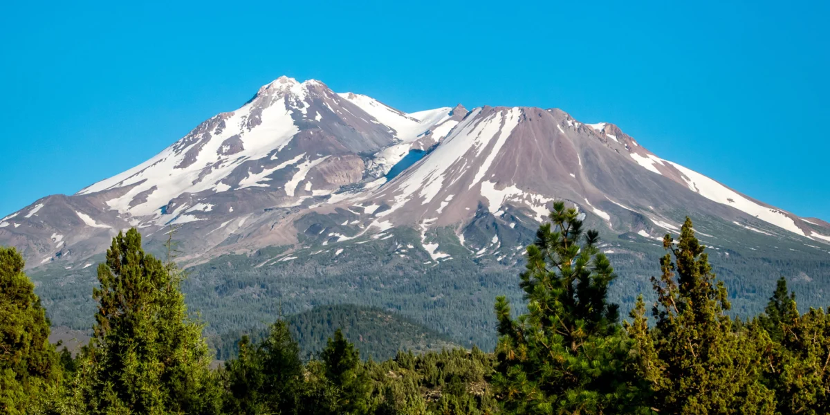
Mount Shasta, the second-highest peak in the Cascade Range, stands at an impressive 14,179 feet (4,322 meters) above sea level. It is a popular destination for climbers, skiers, and mountaineers, attracting thousands of visitors annually. However, its beauty belies its inherent dangers. The mountain is characterized by its steep slopes, volcanic scree, glaciated terrain, and unpredictable weather patterns. Conditions can shift dramatically and rapidly, with clear skies giving way to blizzard-like conditions, high winds, and whiteouts within hours.
Typical ascents of Mount Shasta, even for experienced climbers, often take between 10 to 14 hours round trip, assuming good weather and optimal conditions. Many climbers opt for a multi-day itinerary, establishing a camp at a lower elevation (such as Helen Lake at around 10,400 feet) to acclimatize and launch their summit bid early in the morning. Essential gear includes ice axes, crampons, helmets, proper layering for extreme cold, navigation tools (map, compass, GPS), and ample food and water. Dehydration and altitude sickness are common risks, as are falls on icy or loose terrain. The "turnaround time" of noon is a critical safety protocol, ensuring climbers have sufficient daylight to descend safely before nightfall. The decision by the hikers to push beyond this critical safety window dramatically increased their exposure to risk.
The Role of AI in Expedition Planning: A Double-Edged Sword
The core of this incident lies in the reliance on Google’s Gemini chatbot for expedition planning. While generative AI models like Gemini are powerful tools for synthesizing information, generating text, and answering queries based on vast datasets, their application in safety-critical scenarios like mountaineering presents significant challenges and risks.
The Siskiyou County Sheriff’s Office report specifically noted that the hikers "were advised by Gemini to bring far less food and water than their group required, especially when their planned 8-hour ascent became a multiday ordeal." This highlights a critical limitation of current AI models: they lack real-world experience, contextual understanding, and the ability to assess dynamic variables that are crucial for outdoor safety. An AI chatbot, no matter how advanced, cannot gauge a hiker’s physical fitness, interpret real-time weather changes, understand the nuanced conditions of a specific trail on a given day, or account for unforeseen delays. Its advice is based on aggregated data, which might include ideal-case scenarios or general recommendations that are not tailored to the specific circumstances of an individual or group.
Furthermore, AI models can sometimes "hallucinate," providing plausible but entirely incorrect information, or simply misinterpret the user’s intent or the complexities of a query. In the context of survival, an error in judgment regarding provisions can escalate quickly from an inconvenience to a life-threatening situation, as evidenced by this incident. While AI can certainly assist with research, like compiling gear lists or providing general information about a peak, it cannot replace the critical thinking, experience, and local knowledge that are paramount for safe outdoor recreation.
Official Responses and Safety Directives
Following the rescue, the Siskiyou County Sheriff’s Office issued a clear and unequivocal warning: "It is always advisable to call the local USFS Mount Shasta ranger station ahead of your trip to ensure you have the most accurate information, and to never rely solely on AI for your trip planning." This statement underscores the enduring importance of traditional, verified sources of information and human expertise.
The U.S. Forest Service (USFS), which manages Mount Shasta and issues climbing permits, consistently emphasizes the need for thorough preparation. Their recommendations typically include:
- Consulting local experts: Ranger stations, guide services, and experienced mountaineers provide the most current and accurate information on trail conditions, weather forecasts, and specific hazards.
- Carrying the 10 Essentials: These include navigation (map, compass, GPS), sun protection, insulation (extra clothing), illumination (headlamp), first-aid supplies, fire starter, repair kit, nutrition (extra food), hydration (extra water), and emergency shelter.
- Physical Conditioning: Assessing one’s own fitness level honestly and training adequately for the demands of the climb.
- Contingency Planning: Always having a backup plan, including knowing when to turn back.
- Leave No Trace Principles: Minimizing environmental impact.
Search and rescue organizations also frequently highlight the strain that preventable incidents place on their resources. These operations are often costly, time-consuming, and put the lives of rescuers at risk, particularly in challenging environments like Mount Shasta.
Broader Implications for Outdoor Recreation and AI Use
This Mount Shasta incident serves as a critical case study with broader implications for the rapidly evolving relationship between technology and outdoor recreation. As AI tools become more ubiquitous and sophisticated, the temptation to rely on them for various planning tasks will only increase. However, this incident forcefully reminds us that not all information sources are equal, especially when human safety is at stake.
The implications extend beyond just mountaineering. Whether planning a backcountry camping trip, a multi-day rafting excursion, or even a long-distance cycling tour, the principle remains the same: AI should be viewed as an assistive tool for information gathering, not as a definitive authority for safety-critical decisions. Users bear the ultimate responsibility for verifying information, exercising sound judgment, and prioritizing their safety above all else.
This event also opens a discussion about the responsibilities of AI developers. While companies like Google typically include disclaimers about the accuracy and reliability of AI-generated content, there may be a growing need to specifically address the limitations of AI in contexts where erroneous information could lead to physical harm or death. Educating users on the appropriate and inappropriate uses of AI, particularly in high-risk scenarios, will become increasingly vital.
Expert Perspectives and Recommendations
Experienced mountaineers and outdoor safety experts universally emphasize a multi-faceted approach to trip planning. "There’s no substitute for experience and local knowledge," says Sarah Jenkins, a veteran search and rescue volunteer with two decades of experience in the Cascades. "An AI might tell you the average water consumption, but it won’t know if the stream crossings are dry this year, or if there’s a heatwave coming that will double your needs. You need to talk to rangers, read recent trip reports, and know your own limits."
Mountaineering organizations like the American Alpine Club and the National Outdoor Leadership School (NOLS) consistently advocate for comprehensive training in navigation, wilderness first aid, and self-reliance. They stress that technology, while useful, can fail due to battery drain, signal loss, or damage. Therefore, fundamental skills and analog tools (like a physical map and compass) remain indispensable.
Conclusion
The rescue on Mount Shasta is a potent cautionary tale. While the allure of instant information and seemingly comprehensive planning through AI is strong, the unforgiving realities of nature demand a level of nuanced understanding, adaptive decision-making, and robust preparedness that current artificial intelligence models cannot fully replicate. As we integrate AI more deeply into our lives, this incident serves as a crucial reminder that for adventures into the wild, human wisdom, local expertise, and a healthy respect for the environment must always remain at the forefront of our planning and execution. The Siskiyou County Sheriff’s Office’s advice is clear: call the local experts, pack sufficiently, and never place your safety solely in the hands of an algorithm.