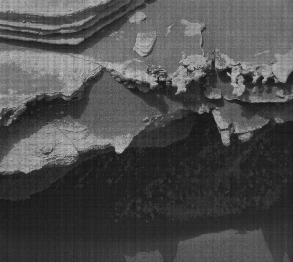
The Mars Science Laboratory (MSL) Curiosity rover has officially returned to its primary objective of ascending Mount Sharp within Gale Crater, following a brief but scientifically productive detour to investigate a unique "erosional surface." As Mars transitions into its autumn season in the southern hemisphere, marked by decreasing temperatures and a reduced likelihood of global dust storms, the rover’s mission team remains vigilant, actively monitoring for any late-season local or regional atmospheric disturbances that could impact operations.
The recent operational cycles, spanning Earth planning dates leading up to August 14, 2026, underscore the meticulous planning and adaptability required for long-duration extraterrestrial missions. Allison Dries-Padilla, a Missions Operations Specialist at Malin Space Science Systems, detailed the complex maneuvers and scientific observations undertaken by the rover, highlighting the continuous pursuit of understanding Mars’ geological and climatic history.
Strategic Return to Mount Sharp Ascent
Curiosity’s journey up Mount Sharp (officially Aeolis Mons) is central to the Mars Science Laboratory mission. This layered mountain, rising approximately 5.5 kilometers (3.4 miles) from the floor of Gale Crater, serves as a natural geological archive. Each successive layer represents a distinct period in Martian history, potentially preserving evidence of past habitable environments. The rover’s ascent allows scientists to systematically examine these layers, seeking clues about how Mars evolved from a potentially wetter, warmer planet to the arid world it is today.
The recent "detour" involved a focused investigation of an erosional surface, a feature that provides critical insights into the processes that have shaped the Martian landscape over billions of years. Such surfaces often mark significant boundaries in geological strata, indicating periods of intense erosion by wind or water, or changes in environmental conditions. By studying these features, the science team can reconstruct the sequence of events that formed Gale Crater and its central peak. This temporary diversion, though delaying the direct ascent, was deemed essential for gathering crucial contextual information about the geological units Curiosity is traversing.
Detailed Scientific Investigations: Sols 4982-4985
The planning cycle for Sols 4982 to 4985 (Martian days) commenced with Curiosity positioned directly facing a distinctive geological feature situated just above the erosional "supersurface contact." This contact point is particularly significant as it represents a boundary between different geological units, potentially revealing a shift in environmental conditions or depositional processes. The opportunity to spend two planning cycles at this location, as noted in previous mission updates, allowed for an unusually thorough examination.
The rover’s suite of advanced scientific instruments was deployed with precision. The Mars Hand Lens Imager (MAHLI), designed to acquire close-up, color images of rocks and soil, was used to reacquire selected images for a mosaic of a target named "Tres Morros." This detailed mosaic provides the science team with an exceptionally focused view of the underside of this feature, which can reveal fine-scale textures, mineralogy, and sedimentary structures that are indicative of its formation history. Understanding the underside of such features can offer clues about how they were exposed or preserved.
The Alpha Particle X-ray Spectrometer (APXS), an instrument capable of determining the elemental composition of Martian surface materials, performed measurements on two bedrock targets. The first target, "El Motacusal," underwent preparation by the Dust Removal Tool (DRT) – a motorized wire brush designed to clear away surface dust and expose fresh rock surfaces. This allows APXS to analyze the intrinsic elemental composition of the rock, free from atmospheric dust contamination. A second APXS measurement was taken on "Alto de Carmen," an "as is" bedrock target, meaning it was analyzed without prior brushing. Comparing the brushed and unbrushed measurements helps scientists understand the composition of both the bedrock and the overlying dust layer. Both APXS targets were meticulously documented with high-resolution images captured by MAHLI, providing crucial visual context for the spectroscopic data.
ChemCam, the Chemistry and Camera instrument, played a vital role in remote sensing. Its Laser Induced Breakdown Spectroscopy (LIBS) capability was employed to analyze the elemental composition of bedrock targets "Lagunas Bravas" and "Parququcha" from a distance. LIBS works by firing a pulsed laser at a target, creating a plasma from which the emitted light reveals the target’s elemental makeup. Additionally, ChemCam’s Remote Micro-Imager (RMI) captured detailed images of "Mishe Mokwa," providing high-resolution visual data to complement the LIBS analyses.
Further enhancing the visual documentation, the Mast Camera (Mastcam) conducted several crucial imaging activities. A near-field mosaic was created of an erosional ridge dubbed "Los Toldos," offering a broad contextual view of the immediate geological surroundings. Another mosaic focused on a more distant bedrock exposure above the erosional surface, named "Los Ladrillos," which helps scientists map the stratigraphy of the area. Beyond these broad views, Mastcam also provided essential color documentation of the previous plan’s ChemCam RMI observations on "Cordillera" and the LIBS activities performed in the current plan. This multi-instrument approach allows for a comprehensive characterization of the Martian surface at various scales.
Navigational Challenges and Continued Contact Science: Sols 4985-4987
Following the intensive scientific operations, Curiosity executed a planned drive of approximately 30 meters (100 feet), relocating to a new position for the subsequent planning cycle, Sols 4985 to 4987. This drive was carefully calculated to bring the rover to an area of flat, potentially geologically interesting bedrock. However, upon arrival, the team encountered a minor but significant navigational challenge: the left-front wheel of the rover was perched on a small rock.
This seemingly minor detail presented a substantial operational constraint for the robotic arm, which houses MAHLI, APXS, and the DRT. To ensure the safety and stability of the rover, the mission team must meticulously assess any risk of slippage or instability before deploying the arm for contact science. In this instance, the concern was that moving the heavy robotic arm could shift the rover’s center of gravity, potentially causing it to slip off the rock. Such an event could damage the arm or other instruments, or compromise the rover’s position.
Despite this constraint preventing the use of the DRT, MAHLI and APXS were still able to safely perform contact science on two bedrock targets: "Mamorecillo" and "Aguas Claras." The team’s ingenuity in adapting to unforeseen terrain challenges is a hallmark of the MSL mission. MAHLI also performed an additional "housekeeping" activity, imaging its calibration target to ensure the accuracy and consistency of its measurements over time.
ChemCam continued its geochemical analysis, utilizing its laser spectrometer to gather data on three targets in the vicinity. These included "Yura Kasa," a dark-toned resistant layer within the bedrock, which is of particular interest as such layers often represent different mineral compositions or cementation processes compared to the surrounding rock. Mastcam complemented these observations with a series of mosaics, continuing to image the stratigraphy of the unit situated above the critical erosional contact. These mosaics are essential for building a three-dimensional understanding of the geological context and tracing layers across the landscape.
Vigilant Environmental Monitoring
A significant portion of the planning cycle for Sols 4985-4987 was dedicated to comprehensive environmental monitoring activities, primarily focused on detecting and characterizing dust storms. As Mars transitions into autumn, the frequency and intensity of major dust storms typically decrease, but localized events can still occur and pose risks to rover operations by reducing solar power generation, obscuring scientific targets, and potentially depositing dust on sensitive instruments.
Mastcam played a crucial role in these monitoring efforts, executing a series of "dust-imaging" observations designed to measure the optical depth, or "tau," of the atmosphere. Tau is a quantitative measure of how much light is absorbed or scattered by dust particles in the atmosphere. A higher tau value indicates a greater concentration of dust. These measurements are vital for tracking atmospheric dust loading and understanding seasonal variations in the Martian atmosphere.
APXS contributed to the environmental data by planning an overnight atmospheric measurement. While primarily a surface chemistry instrument, APXS can also be used to detect argon in the atmosphere, providing additional insights into atmospheric composition and density variations.
However, the bulk of the "heavy lifting" for dust storm monitoring fell to the Navigation Camera (Navcam). Navcam’s wide field of view and regular imaging capabilities make it ideal for observing atmospheric phenomena. Its activities included multiple large dust-devil surveys, designed to capture these swirling columns of dust that are common on Mars. These surveys help scientists understand the dynamics of atmospheric convection and dust transport. Navcam also performed zenith observations, looking directly upwards to assess cloud cover and atmospheric haze, and in-crater line-of-sight observations, which track atmospheric clarity across the Gale Crater floor. Finally, suprahorizon cloud movies were captured, providing valuable data on high-altitude cloud formations, which can offer clues about atmospheric circulation patterns and water vapor cycles.
Broader Implications and Future Trajectory
The meticulous work conducted by Curiosity and its mission team on Sols 4982-4987 represents another incremental yet critical step in understanding Mars’ complex history. The data gathered from "Tres Morros," "El Motacusal," "Alto de Carmen," "Lagunas Bravas," "Parququcha," "Mishe Mokwa," "Los Toldos," "Los Ladrillos," "Mamorecillo," "Aguas Claras," and "Yura Kasa" will be integrated into the growing scientific mosaic of Gale Crater. Each rock analysis, each image, and each atmospheric measurement contributes to a more complete picture of Mars’ geological evolution, its past habitability, and its present-day climate.
The investigation of the erosional surface and the subsequent resumption of the ascent up Mount Sharp are particularly significant. The contact zones between geological units, like the "supersurface contact," are often where the most dramatic environmental changes are recorded. By carefully analyzing these boundaries, scientists can pinpoint when and how conditions on Mars shifted, potentially from a wetter environment capable of supporting microbial life to the cold, dry desert it is today. The "dark-toned resistant layer" in "Yura Kasa," for example, could represent a different mineralogical phase, possibly indicating ancient hydrothermal activity, altered sediments, or even a period of volcanic deposition.
The ongoing environmental monitoring is not merely for operational safety; it also contributes to long-term climate studies. Understanding the frequency, intensity, and distribution of dust storms is crucial for planning future human missions to Mars, as these events can significantly impact mission infrastructure, power generation, and crew health. The detailed atmospheric observations provide data for refining climate models, helping scientists predict future Martian weather patterns.
Curiosity, having far surpassed its primary mission duration, continues to be a resilient explorer. Its planned drive distance of approximately 47 meters (150 feet) southwest of its current location signifies a steady, deliberate climb up Mount Sharp. The mission team anticipates returning on Monday for another week packed with contact science, remote sensing, and further driving, pushing the boundaries of discovery on the red planet, sol by sol. The rover’s journey continues to exemplify humanity’s enduring quest to unravel the mysteries of our solar system and search for life beyond Earth.