
The William T. Pecora Award holds a unique place in the scientific community, jointly sponsored by the U.S. Department of the Interior (DOI) and the National Aeronautics and Space Administration (NASA). Established in 1974, the award serves as a perpetual tribute to the memory and visionary leadership of Dr. William T. Pecora, a pivotal figure in the history of American Earth science. Dr. Pecora, who served as Director of the USGS and later as Under Secretary of the Department of the Interior, was a fervent advocate and driving force behind the establishment of a comprehensive program for civil remote sensing of the Earth from space. His pioneering vision and steadfast support were instrumental in laying the groundwork for what has since become the globally recognized and indispensable Landsat satellite program. The nomination window for the 2026 award will remain open until May 29, 2026, inviting submissions that exemplify the spirit of innovation and dedication to Earth science that Dr. Pecora championed. Prospective nominators are encouraged to visit the official William T. Pecora Awards webpage on the USGS platform for detailed eligibility requirements and the comprehensive nomination process.
The Enduring Legacy of Dr. William T. Pecora
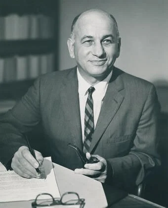
Dr. William Thomas Pecora (1913-1972) was a geologist whose illustrious career profoundly shaped the trajectory of Earth observation. A graduate of Princeton University with a Ph.D. in geology, Pecora joined the USGS in 1939. His early work focused on mineralogy and economic geology, particularly in Brazil, before he rose through the ranks of the agency. He was appointed Director of the USGS in 1965, a position he held until 1971. During his tenure as Director, Pecora championed the use of advanced technologies to understand the Earth’s processes and resources. He was a vocal proponent of integrating space-based platforms into geological research and resource management, recognizing the unparalleled perspective they offered.
Pecora’s most significant contribution, and the very foundation upon which the award bearing his name rests, was his relentless advocacy for a civilian Earth observation satellite program. In the nascent days of space exploration, the focus was largely on human spaceflight and military applications. Pecora, however, saw the immense potential for satellite technology to provide systematic, repetitive, and synoptic views of the Earth’s surface for scientific research, environmental monitoring, and resource management. He argued passionately for a program that would transcend individual research projects and offer a continuous, publicly available data stream. This vision directly led to the development of the Earth Resources Technology Satellite (ERTS) program, which was subsequently renamed Landsat.

His efforts were not without challenges, requiring extensive collaboration and persuasion across multiple government agencies, including NASA, the Department of Defense, and various academic institutions. Pecora’s ability to articulate the long-term benefits of such a program, from monitoring agricultural health and forest cover to assessing geological hazards and water resources, ultimately convinced policymakers of its necessity. His promotion to Under Secretary of the Department of the Interior in 1971 further solidified his influence, allowing him to oversee the final stages of the ERTS-1 development before its launch in July 1972. Tragically, Dr. Pecora passed away just months after the successful launch of ERTS-1, never fully witnessing the profound and enduring impact of the program he so ardently championed. The establishment of the William T. Pecora Award in 1974, two years after his death, was a fitting tribute to a man whose foresight irrevocably changed how humanity views and understands its home planet.
The Landsat Program: A Half-Century of Earth Monitoring
The Landsat program, a direct realization of Pecora’s vision, stands as the longest-running continuous Earth observation program from space. Since the launch of ERTS-1 (later retroactively renamed Landsat 1) in 1972, a series of Landsat satellites have consistently provided a nearly unbroken, 50-year record of Earth’s land surfaces. This unparalleled archive of imagery has become an invaluable resource for scientists, resource managers, and policymakers worldwide.
Chronology of Landsat Missions:
- Landsat 1 (ERTS-1): Launched July 23, 1972. Demonstrated the feasibility of continuous Earth observation.
- Landsat 2: Launched January 22, 1975. Extended the data record.
- Landsat 3: Launched March 5, 1978. Continued data collection.
- Landsat 4: Launched July 16, 1982. Introduced the Thematic Mapper (TM) sensor, significantly improving spatial and spectral resolution.
- Landsat 5: Launched March 1, 1984. Operated for an unprecedented 29 years, becoming one of the longest-serving Earth observation satellites.
- Landsat 6: Launched October 5, 1993. Failed to reach orbit.
- Landsat 7: Launched April 15, 1999. Featured the Enhanced Thematic Mapper Plus (ETM+). Despite a scan line corrector failure in 2003, it continued to provide valuable data.
- Landsat 8: Launched February 11, 2013. Carries the Operational Land Imager (OLI) and Thermal Infrared Sensor (TIRS), offering enhanced capabilities.
- Landsat 9: Launched September 27, 2021. Designed to ensure data continuity with Landsat 8, improving data quality and collection efficiency.
The success of Landsat lies not only in its longevity but also in its pioneering "free and open data policy," implemented by the USGS in 2008. Prior to this, Landsat data was costly, limiting its widespread use. The decision to make the entire Landsat archive freely accessible unleashed a torrent of scientific research, leading to an exponential increase in the application of Landsat data across diverse fields. This policy has been emulated by other space agencies and has fundamentally democratized access to crucial environmental information.

The Breadth of Remote Sensing Contributions
The William T. Pecora Award’s criteria reflect the multifaceted utility of remote sensing. Nominees are recognized for their contributions in four key areas:
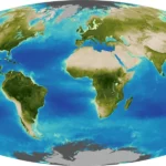
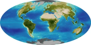
- Understanding the Earth (Land, Oceans, and Air): Remote sensing data, particularly from Landsat, has revolutionized our understanding of Earth’s dynamic systems. For instance, data analysis has quantified global deforestation rates, tracked glacier and ice sheet retreat, monitored changes in agricultural land use, mapped urban expansion, and assessed the health of coastal ecosystems. Scientists use these data to develop sophisticated climate models, predict future environmental changes, and understand complex interactions between human activities and natural processes. The sheer volume of data, now in the petabytes, allows for trend analysis over decades, revealing subtle yet significant shifts in Earth’s surface. For example, Landsat imagery has been crucial in monitoring the loss of rainforests in the Amazon and Borneo, providing visual evidence for conservation efforts and policy formulation.
- Educating the Next Generation of Scientists: Award recipients often include individuals who have excelled in teaching and mentoring, developing curricula, or creating innovative tools that make remote sensing accessible to students and early-career researchers. This ensures the continued growth of the Earth observation community and equips future generations with the skills needed to tackle pressing environmental challenges. Educational initiatives leveraging Landsat data have ranged from university-level remote sensing courses to K-12 programs that introduce students to geographic information systems (GIS) and satellite imagery interpretation.
- Informing Decision-Makers: The practical applications of remote sensing are vast, directly aiding government agencies, non-governmental organizations, and international bodies in making informed decisions. Landsat data, for example, is used by urban planners to manage growth, by agricultural agencies to monitor crop health and predict yields, by water resource managers to track drought conditions and allocate resources, and by conservationists to identify critical habitats and monitor biodiversity. Its role in land management, urban planning, and resource allocation provides objective, verifiable data that underpins evidence-based policy.
- Supporting Natural or Human-Induced Disaster Response: In times of crisis, remote sensing offers an unparalleled ability to assess damage, track unfolding events, and guide relief efforts. From mapping the extent of wildfires and floods to assessing the impact of earthquakes and tsunamis, satellite imagery provides critical information in areas that may be inaccessible or too dangerous for ground teams. This enables emergency responders to prioritize resources, identify affected populations, and plan recovery operations more effectively. For example, during major hurricane seasons, Landsat and other satellite data are quickly processed to show affected areas, helping FEMA and other organizations direct aid.
Broader Impact and Implications
The annual call for nominations for the William T. Pecora Award serves as more than just an administrative announcement; it is a reaffirmation of the enduring importance of Earth observation and the legacy of scientific foresight. The award highlights the collaborative spirit between DOI and NASA, two agencies critical to the nation’s scientific and environmental stewardship. Their joint sponsorship underscores the interdisciplinary nature of Earth science, where geological understanding, atmospheric research, and space technology converge.
The award ceremony itself often brings together leading scientists, policymakers, and industry representatives, fostering dialogue and collaboration on the future of remote sensing. It inspires new generations of researchers to pursue careers in Earth science, pushing the boundaries of what is possible with satellite technology. The types of projects recognized by the award demonstrate the continuous evolution of remote sensing applications, from fundamental scientific discovery to direct societal benefits.
In an era defined by global challenges such as climate change, rapid urbanization, and resource scarcity, the insights derived from remote sensing are more critical than ever. The Landsat program, born from Dr. Pecora’s vision, continues to be a cornerstone of these efforts, providing the foundational data necessary to monitor, understand, and address these complex issues. The Pecora Award, by celebrating excellence in this field, reinforces the value of sustained investment in Earth observation infrastructure and the brilliant minds that interpret its data. It implicitly calls upon the international scientific community to continue innovating, collaborating, and applying remote sensing technologies to ensure a more sustainable and informed future for all.

As the May 29, 2026, deadline approaches, the USGS Landsat Missions anticipate a robust pool of nominees, each representing significant advancements in the use of remote sensing for the betterment of Earth science and humanity. The award serves not only to honor past achievements but also to catalyze future breakthroughs, ensuring that the legacy of Dr. William T. Pecora continues to inspire progress in understanding our planet from the unique vantage point of space.