


For the first time in human history, scientists are continuously measuring the dynamic behavior of rivers across the entire globe, fundamentally transforming our understanding of these essential freshwater arteries. This monumental achievement is courtesy of the Surface Water and Ocean Topography (SWOT) mission, an ambitious international collaboration spearheaded by NASA’s Jet Propulsion Laboratory (JPL) and the Centre National d’Études Spatiales (CNES) of France, with significant contributions from the Canadian Space Agency (CSA) and the United Kingdom Space Agency (UKSA). The data streaming from SWOT is providing an unparalleled, high-resolution view of how rivers flow, how their characteristics evolve over time, and the intricate ways they support ecosystems, economies, and communities worldwide, from the vast stretches of the Amazon to the meandering paths of the Mississippi.
A New Era in Hydrological Observation
Historically, monitoring the world’s rivers has been a fragmented and challenging endeavor. Ground-based river gauges, while precise at specific points, offer limited spatial coverage and are often concentrated in developed regions, leaving vast areas of the planet unmonitored. Traditional satellite altimetry missions, like Jason-3, provided valuable point measurements of water height but lacked the spatial resolution to capture the width and slope of most rivers effectively. SWOT represents a paradigm shift, overcoming these limitations with its innovative Ka-band Radar Interferometer (KaRIn) instrument. This cutting-edge technology allows the satellite to measure the height of water surfaces across swaths of land and ocean up to 120 kilometers wide, with unprecedented accuracy and resolution. This capability enables scientists to observe not just single points, but entire river segments, providing critical data on water surface elevation, width, and slope, which are essential for calculating river discharge or flow. The mission’s global coverage extends to rivers wider than 100 meters, and in some cases, down to 50 meters, along with lakes and reservoirs larger than 250 by 250 meters.
The Genesis of a Groundbreaking Mission: A Chronology
The journey to SWOT’s launch was a multi-decade effort, born from a recognized need within the scientific community for a comprehensive global freshwater monitoring system.
- Early 2000s: Initial concepts for a wide-swath altimetry mission began to coalesce within the scientific community, driven by the limitations of existing satellite and ground-based hydrological measurements.
- 2007: The National Research Council’s Decadal Survey for Earth Science identified a surface water and ocean topography mission as a high-priority endeavor, underscoring its potential to revolutionize hydrology and oceanography.
- 2009: NASA formally initiated the SWOT mission concept, beginning the arduous process of instrument development and mission design, with JPL taking the lead on the KaRIn instrument.
- 2012: CNES officially joined the mission as a key partner, bringing its extensive expertise in satellite altimetry and contributing significantly to the spacecraft bus and ground segment.
- 2014: The Canadian Space Agency committed to providing key components, including the KaRIn instrument’s Extended Interaction Klystron (EIK) and a contribution to the mission’s science data processing. The UK Space Agency also joined, contributing to mission development and scientific exploitation.
- Late 2010s: Intensive development, testing, and integration phases for the satellite and its instruments took place at various facilities, including JPL and CNES.
- October 2022: The SWOT satellite was shipped to its launch site at Vandenberg Space Force Base in California, signaling the final preparations for liftoff.
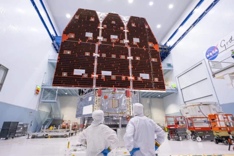
- December 16, 2022: SWOT was successfully launched aboard a SpaceX Falcon 9 rocket from Vandenberg, embarking on its ambitious mission to map Earth’s water.
- January – July 2023: Following launch, the mission entered a commissioning and calibration phase. This critical period involved deploying the KaRIn antennas, powering up and testing all instruments, and meticulously calibrating the data against known ground truth sites to ensure accuracy.
- July 2023 onwards: SWOT began its nominal science operations phase, systematically collecting and delivering global surface water data to the scientific community.
Unlocking Critical Data for a Thirsty Planet
The data delivered by SWOT is far more than just surface height measurements; it provides a holistic picture of river dynamics. By combining surface height with river width and slope, scientists can estimate discharge volumes—the amount of water flowing through a river at any given time. This capability is transformative, especially for the vast majority of the world’s rivers that lack continuous monitoring. For example, the mission is capturing the subtle changes in the water levels of the Congo River Basin, crucial for understanding its role in regional climate and biodiversity, or mapping the ephemeral flows in arid regions, providing insights into scarce water resources.
Before SWOT, global estimates of river discharge relied heavily on hydrological models that were often limited by sparse input data, leading to significant uncertainties. SWOT’s direct observations are now serving as a powerful constraint for these models, leading to more accurate predictions of floods, droughts, and overall water availability. The mission completes a global "wet surface" map approximately every 21 days, providing a dynamic, evolving record of Earth’s freshwater resources. This frequent revisit rate allows for the observation of seasonal changes, the impacts of extreme weather events, and long-term trends influenced by climate change. The sheer volume of data, processed and disseminated through publicly accessible platforms, marks a significant leap forward in Earth observation.
Voices from the Mission: Collaborative Success
The success of the SWOT mission is a testament to the power of international scientific collaboration. Dr. Parag Vaze, SWOT Project Manager at NASA’s Jet Propulsion Laboratory, emphasized the groundbreaking nature of the data: "SWOT is providing us with an unprecedented global snapshot of our planet’s freshwater. We’re not just seeing how rivers rise and fall at a few points, but how entire river systems are responding to environmental changes. This level of detail was simply unimaginable just a few years ago and will be critical for managing water resources in a changing climate."
From the European side, Dr. Selma Cherchali, SWOT Project Manager at CNES, highlighted the collaborative spirit: "The partnership between NASA, CNES, CSA, and UKSA has been instrumental. Each agency brought unique expertise, from instrument development to data processing, making this complex mission a reality. The KaRIn instrument is performing beyond expectations, delivering data that is truly revolutionizing our understanding of the global water cycle."
Dr. Karen St-Germain, President of the Canadian Space Agency, noted the broader implications: "Canada’s contributions to SWOT underscore our commitment to global climate action and environmental monitoring. The insights gained from SWOT’s measurements of lakes and rivers, particularly in the vast, often remote regions of the Canadian Arctic, are vital for understanding the impacts of climate change on vulnerable ecosystems and communities." Similarly, a spokesperson for the UK Space Agency added, "The UK’s involvement in SWOT ensures our scientists are at the forefront of hydrological research, utilizing this rich dataset to improve flood forecasting, drought monitoring, and water management strategies both domestically and internationally."
Profound Implications for a Changing World
The detailed, continuous data from SWOT carries profound implications across multiple scientific disciplines and societal sectors:
- Climate Change Monitoring and Adaptation: Rivers are critical conduits in the global water cycle, transporting water, sediment, and nutrients. SWOT’s data helps quantify how climate change is altering river flow regimes, leading to more intense floods in some regions and prolonged droughts in others. This improved understanding is crucial for developing more resilient infrastructure and adaptive water management strategies. It also provides insights into how freshwater input from rivers affects ocean circulation and sea-level rise.
- Water Resource Management: With growing global populations and increasing water demand, efficient water resource management is paramount. SWOT’s ability to monitor reservoir levels and river discharge globally will enable better planning for agriculture, hydropower generation, and urban water supply, especially in transboundary river basins where data sharing can be contentious.
- Ecosystem Health and Biodiversity: Aquatic ecosystems are highly sensitive to changes in water flow and habitat availability. By revealing variations in river width, depth, and velocity, SWOT data helps scientists assess the health of riverine ecosystems, track habitat degradation, and understand the impact of human activities and climate change on freshwater biodiversity. This is vital for conservation efforts and protecting species dependent on specific hydrological conditions.
- Disaster Preparedness and Risk Mitigation: Accurate and timely information on river levels is foundational for flood forecasting and drought early warning systems. SWOT data improves the initialization of hydrological models, leading to more precise predictions of flood inundation zones and the severity of droughts. This allows communities to prepare more effectively, saving lives and reducing economic losses.
- Scientific Discovery: Beyond immediate applications, SWOT is expected to foster entirely new scientific discoveries. By providing a global, consistent dataset, researchers can investigate previously unobservable phenomena, such as the teleconnections between distant river systems, the precise role of small rivers in the global carbon cycle, or the impact of land-use changes on regional hydrology at an unprecedented scale.
The SWOT mission is more than just another satellite; it is a dedicated observatory for Earth’s surface water, providing the critical data needed to navigate the complex challenges of a changing planet. As the data continues to flow, scientists, policymakers, and communities worldwide will gain an ever-clearer picture of our vital waterways, empowering them to make informed decisions for a sustainable future.