


NASA’s Earth Science Division (ESD) has strategically established the Commercial Satellite Data Acquisition (CSDA) program, an initiative designed to harness the burgeoning capabilities of the commercial space sector for the advancement of the agency’s critical Earth science research and application objectives. This forward-looking program is systematically identifying, assessing, and acquiring high-quality data from a diverse array of commercial providers, with the explicit goal of supplementing and enriching the vast Earth observation datasets currently collected by NASA, other U.S. Government agencies, and international collaborative partners. The underlying rationale is to secure a cost-effective and agile means of expanding the scope, resolution, and temporal frequency of Earth observations, thereby enhancing scientific understanding of our planet’s complex systems. A forthcoming NASA CSDA program vendor webinar is slated to prominently feature MDA Space, a global leader in satellite technology, and will delve into the intricacies of their C-band Synthetic Aperture Radar (SAR) products, demonstrating their profound relevance and utility to the Earth science community.
The Strategic Imperative of Commercial Data Acquisition
The establishment of the CSDA program in 2017 marked a significant pivot in NASA’s approach to Earth observation, acknowledging the rapid maturation and innovative capacity of the commercial space industry. Traditionally, government agencies bore the primary responsibility for developing, launching, and operating Earth observation satellites. However, the commercial sector has increasingly demonstrated the ability to provide high-quality, specialized data at competitive costs, often with faster revisit times and novel sensor configurations. NASA recognized that integrating these commercial assets could provide significant advantages:
- Cost-Effectiveness: Acquiring data as a service from commercial entities can be more economical than designing, building, launching, and maintaining proprietary satellite missions for every data need.
- Data Diversity and Volume: Commercial providers offer a wider range of sensor types, spatial resolutions, and temporal coverages, supplementing existing government missions.
- Agility and Responsiveness: Commercial constellations often boast rapid revisit capabilities, crucial for monitoring dynamic phenomena like natural disasters or rapidly changing environmental conditions.
- Risk Mitigation: Leveraging commercial data allows NASA to de-risk new observational capabilities and explore novel applications without the full upfront investment of a dedicated mission.
The CSDA program operates under a robust framework that involves rigorous scientific and technical evaluation of commercial datasets to ensure they meet NASA’s stringent quality standards and mission requirements. This includes assessing data accuracy, precision, calibration, and the ability to be integrated seamlessly with existing scientific workflows and archives. The program has already successfully acquired data from several commercial vendors, demonstrating its efficacy in diverse applications ranging from land use change detection to sea ice monitoring.
MDA Space and the Power of C-Band SAR
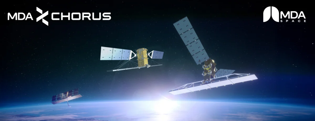
The upcoming webinar’s focus on MDA Space underscores the increasing importance of Synthetic Aperture Radar (SAR) technology in Earth observation. MDA Space, a prominent Canadian space technology company with a rich heritage in satellite systems, is particularly renowned for its advanced SAR capabilities. Their flagship contributions to Earth observation include the RADARSAT-2 satellite and, more recently, their pivotal role in the RADARSAT Constellation Mission (RCM), operated by the Canadian Space Agency.
Synthetic Aperture Radar is a sophisticated remote sensing technique that uses microwave pulses to create high-resolution images of the Earth’s surface. Unlike optical sensors, which rely on visible light and are often hampered by cloud cover, darkness, or smoke, SAR operates independently of solar illumination and can penetrate clouds, light rain, and even vegetation to varying degrees. This all-weather, day-and-night capability makes SAR an indispensable tool for continuous monitoring, particularly in regions prone to persistent cloudiness or during emergencies where immediate data is critical.
MDA Space’s C-band SAR systems, such as those aboard RADARSAT-2 and RCM, transmit and receive signals in the C-band frequency (approximately 5.3 GHz). This specific wavelength offers a unique balance of penetration and sensitivity to surface characteristics, making it exceptionally valuable for a wide range of applications:
- Maritime Surveillance: Monitoring ship traffic, detecting oil spills, and tracking icebergs in critical shipping lanes.
- Disaster Management: Mapping flood extents, assessing earthquake damage, and monitoring volcanic activity, often providing the first clear view of affected areas after an event.
- Environmental Monitoring: Tracking deforestation, monitoring wetland changes, assessing soil moisture, and observing glacial melt and ice sheet dynamics.
- Resource Management: Supporting agriculture through crop monitoring and yield estimation, and assisting in infrastructure monitoring for pipeline integrity and urban expansion.
The RADARSAT Constellation Mission, a trio of identical C-band SAR satellites, is particularly notable for its rapid revisit capability, offering daily coverage of Canada’s vast landmass and oceans, and an average of four-day revisit globally. This frequent imaging is crucial for observing dynamic processes and provides an unprecedented level of detail for change detection over short timeframes.
The Webinar: Bridging Commercial Data and Scientific Research
The NASA CSDA program vendor webinar featuring MDA Space is meticulously designed to serve as a crucial bridge between commercial data providers and the scientific user community. Speakers from MDA Space will provide a comprehensive introduction to their satellite constellation, detailing the technical specifications, operational parameters, and data acquisition strategies. A significant portion of the webinar will be dedicated to practical demonstrations, guiding participants through the process of discovering, accessing, and effectively working with MDA’s C-band SAR products. This hands-on approach is vital for ensuring that researchers can seamlessly integrate these commercial datasets into their existing workflows.

Key topics to be covered include:
- Data Discovery: How users can navigate MDA’s data archives and platforms to locate specific SAR products relevant to their research.
- Data Access: The mechanisms for acquiring data, including potential APIs, portals, and data formats.
- Data Processing and Analysis: Guidance on common software tools and methodologies for processing SAR data, interpreting radar backscatter, and extracting meaningful information. This may involve discussions on calibration, geometric correction, speckle filtering, and change detection techniques.
- Complementary Value: A detailed explanation of how MDA’s C-band SAR data products enhance and complement NASA’s existing Earth science data holdings. For instance, while NASA’s optical missions like Landsat and MODIS provide invaluable spectral information, SAR’s all-weather capability offers continuity during cloudy periods and unique insights into surface roughness, moisture content, and structural changes not readily apparent in optical imagery. This synergy allows for a more holistic and robust understanding of Earth system processes.
- User Services and Support: Information on the support infrastructure available to data users, including technical assistance, documentation, training resources, and community forums. This is critical for fostering a vibrant user base and ensuring successful data utilization.
The webinar serves not only as an informational session but also as a platform for fostering collaboration and direct engagement between the commercial sector and the scientific community, ensuring that the acquired data maximizes its scientific return.
A Timeline of Public-Private Partnerships in Earth Observation
The evolution of NASA’s engagement with commercial Earth observation data can be traced through several key milestones:
- Early 2000s: Initial explorations into commercial imagery acquisition, often on an ad-hoc basis for specific projects.
- 2010s: Increasing recognition of the potential of commercial small satellites and constellations. NASA begins to formalize frameworks for evaluating and acquiring commercial data.
- 2017: Establishment of the Commercial Satellite Data Acquisition (CSDA) program, providing a structured, programmatic approach to commercial data integration. This marked a strategic shift from individual mission-specific acquisitions to a broader, agency-wide initiative.
- 2018-Present: CSDA issues multiple solicitations and awards contracts to various commercial providers, including those offering high-resolution optical imagery, radio occultation data, and increasingly, SAR data. These early acquisitions demonstrate the program’s viability and the quality of commercial offerings.
- 2020-Present: Increased emphasis on integrating commercial data into operational applications and long-term scientific research, moving beyond purely experimental use. The focus on SAR data, as exemplified by the MDA Space webinar, reflects the growing demand for its unique capabilities in a changing climate.
This chronology highlights a clear trend towards greater reliance on and integration of commercial capabilities, signifying a maturation of the public-private partnership model in space.
Inferred Statements and Broader Implications
"The CSDA program represents a cornerstone of NASA’s strategy to expand our understanding of Earth’s complex systems," an official from NASA’s Earth Science Division might state. "By partnering with innovative commercial entities like MDA Space, we are able to leverage cutting-edge technologies like C-band SAR, providing our scientists with unprecedented views of our planet, regardless of weather conditions or time of day. This data is not just supplemental; it’s transformative, opening new avenues for research in areas from climate change to disaster response."
A CSDA Program Manager could add, "Our rigorous evaluation process ensures that the commercial data we acquire meets the highest scientific standards. The collaboration with MDA Space on C-band SAR data is particularly exciting as it directly complements NASA’s existing satellite assets, filling critical observational gaps and enhancing our ability to monitor dynamic processes globally. This webinar is a vital step in empowering our research community to fully utilize these powerful new data streams."
From MDA Space’s perspective, a company representative might remark, "We are immensely proud to partner with NASA through the CSDA program. Our C-band SAR capabilities, honed over decades through missions like RADARSAT-2 and the RADARSAT Constellation Mission, offer robust, all-weather, day-and-night imaging essential for critical Earth observation tasks. Providing access to this data for NASA’s world-leading Earth scientists not only validates our technology but also ensures that our commercial investments contribute directly to global scientific advancement and societal benefit."
The implications of this growing partnership are far-reaching:
- Enhanced Scientific Discovery: The expanded access to diverse and frequent data streams will enable scientists to develop more accurate models of Earth systems, better understand environmental changes, and improve predictions of future climate scenarios. The unique insights offered by SAR data, particularly in areas like ice dynamics, forest biomass estimation, and flood mapping, will contribute significantly to various scientific disciplines.
- Improved Operational Applications: Data from commercial SAR constellations will bolster capabilities in disaster management, allowing for faster and more precise assessments of damage from floods, earthquakes, and other events, thereby aiding humanitarian efforts and recovery operations. It will also enhance maritime security and agricultural monitoring.
- Democratization of Data Access: The CSDA program facilitates broader access to sophisticated satellite data for a wider research community, including universities and smaller research institutions that might not have the resources to engage with commercial providers directly.
- Strengthening Public-Private Partnerships: This initiative further solidifies the model of collaboration between government agencies and the private sector, demonstrating how strategic partnerships can accelerate innovation and deliver greater value than either sector could achieve alone. It sets a precedent for future space endeavors, from lunar exploration to deep-space missions.
- Economic Impact: The program not only supports commercial space companies by providing a stable customer but also stimulates the development of new data analytics tools and services, creating a vibrant ecosystem around Earth observation data.
The integration of commercial C-band SAR data from MDA Space into NASA’s Earth science portfolio through the CSDA program represents a pivotal moment in the evolution of Earth observation. It signifies a future where public and private entities collaboratively leverage advanced technologies to deepen our understanding of our changing planet, providing critical insights necessary for informed decision-making and sustainable management of Earth’s resources. As the program continues to mature, its impact on scientific discovery and operational applications will undoubtedly grow, ushering in a new era of comprehensive and responsive Earth monitoring.