



A formidable magnitude 7.3 earthquake dramatically struck off the southern coast of Mexico on Friday, sending seismic tremors across the region and prompting an immediate tsunami warning for adjacent Pacific coastlines. While the initial alarm was significant, particularly given the seismic intensity, subsequent reports from Mexico, Guatemala, and El Salvador confirmed that no fatalities or widespread severe damage had occurred, a testament to timely warnings and potentially the quake’s specific characteristics.
The seismic event, which occurred near the fishing town of Puerto Madero in Mexico, was initially recorded at 08:49 local time (14:49 GMT). The United States Geological Survey (USGS) placed its hypocenter at a relatively shallow depth of 15.2 kilometers (approximately 9 miles), a factor that often amplifies the felt intensity on the surface and increases the potential for tsunami generation. The proximity to populated coastal areas in Mexico and Guatemala, combined with the significant magnitude, necessitated swift action from regional and international warning systems.
Chronology of a Regional Tremor
The sequence of events unfolded rapidly following the initial seismic shock. At 08:49 local time, the earth beneath the Pacific Ocean, approximately 125 kilometers (78 miles) southwest of Pijijiapan, Chiapas, Mexico, shifted violently. Within minutes, seismic monitoring stations across North and Central America registered the powerful tremor.
The US Tsunami Warning System, a critical component of the Pacific Tsunami Warning Center (PTWC), quickly processed the seismic data. Recognizing the potential for hazardous wave generation from a shallow, powerful earthquake in an oceanic subduction zone, it issued a warning of possible "hazardous tsunami waves" along the nearby coasts of Mexico and Guatemala. This alert immediately mobilized emergency response agencies in both nations, initiating coastal evacuations and public advisories.
Approximately an hour after the initial quake, the first measurable tsunami waves began to arrive at coastal monitoring stations. The US Tsunami Warning System recorded waves of 0.3 meters (1.1 feet) above tide level in Puerto Madero and Chiapas, Mexico. While these measurements represent relatively small amplitudes compared to devastating tsunamis of the past, their existence confirmed the generation of a seismic sea wave and underscored the validity of the initial warning. These waves, characterized by their long periods, persisted for 12 minutes in Puerto Madero and 28 minutes in Chiapas, highlighting the extended duration of tsunami phenomena compared to typical ocean swells.
Several hours after the initial warning was disseminated, and with continuous monitoring showing no further significant wave activity, the US Tsunami Warning System downgraded and eventually cancelled the full-scale threat. However, it prudently advised populations in affected areas to "remain observant and exercise normal caution near the sea," acknowledging the unpredictable nature of post-seismic ocean dynamics. The region then experienced a series of aftershocks, ranging in magnitude from 4.7 to 6, which, while smaller, kept emergency services on high alert and served as a reminder of the ongoing tectonic adjustments. One notable aftershock, a magnitude 5.6, was specifically cited by Guatemala’s President Bernardo Arévalo, with its epicenter near Quetzaltenango, further highlighting the widespread seismic activity.
Understanding the Earth’s Dynamics: Seismic Activity and Tsunami Generation
The powerful earthquake off Mexico’s southern coast is a stark reminder of the dynamic geological forces at play in a region famously situated within the "Ring of Fire." This horseshoe-shaped belt around the Pacific Ocean is characterized by frequent seismic activity and volcanic eruptions, a direct result of the movement and collision of tectonic plates.
Specifically, this earthquake occurred along the Middle America Trench, a major subduction zone where the Cocos Plate is actively diving beneath the North American Plate. This geological process, known as subduction, generates immense stress within the Earth’s crust. When this accumulated stress is suddenly released, it results in earthquakes, often powerful ones like the magnitude 7.3 event recorded. The relatively shallow depth of 15.2 kilometers is particularly significant; shallower earthquakes tend to produce stronger shaking at the surface and are more efficient at displacing the seafloor, a critical factor in tsunami generation.
A tsunami, unlike a normal ocean wave generated by wind, is a series of incredibly powerful ocean waves caused by the sudden displacement of a large volume of water. This displacement is most commonly triggered by underwater earthquakes, especially those occurring in subduction zones where one tectonic plate abruptly slips past another, vertically shifting the seabed. The energy from this vertical displacement propagates through the entire water column, creating waves that can travel across entire oceans at speeds comparable to a jet airliner. In deep ocean, these waves might only be a few feet high, making them imperceptible to ships. However, as they approach shallower coastal waters, the energy compresses, causing the waves to dramatically increase in height, sometimes reaching tens of meters. The NOAA report correctly emphasized that a tsunami is a series of waves, with periods between crests ranging from five minutes to an hour, and can persist for many hours, making prolonged vigilance crucial.
The magnitude 7.3 on the Richter scale indicates a significant release of energy. Each whole number increase on the magnitude scale represents a tenfold increase in measured wave amplitude and approximately 32 times more energy released. A 7.3 magnitude earthquake is considered a major earthquake, capable of causing widespread severe damage in populated areas if it occurs close to the surface and landmass. The fact that this event caused minimal damage onshore, despite its power, speaks to its offshore epicenter and the preparedness measures in place.
Official Responses and Regional Vigilance
The rapid and coordinated response from national and international agencies played a crucial role in mitigating potential hazards.
In Mexico, the immediate focus was on assessing coastal impact and advising the public. Mexico’s navy secretary, Admiral Raymundo Morales, reassured the public in a press conference, stating there was "no serious impact" but emphasized the importance of public safety by advising people to stay away from beaches. This cautionary measure is standard procedure during tsunami warnings, even for small waves, given the unpredictable currents and potential for larger, subsequent waves.
Governors of the directly affected Mexican states also provided updates. Governor Salomón Jara Cruz of Oaxaca reported that the quake was felt with "moderate intensity" across his southern state, yet critically, no significant structural damage or injuries had been reported. Similarly, Eduardo Ramírez, governor of Chiapas, the state closest to the epicenter, confirmed no serious immediate impact. As a precautionary measure, Governor Ramírez instructed his cabinet to suspend administrative activities and urged the private sector to follow suit, allowing for a comprehensive assessment of infrastructure and ensuring public safety without the pressure of daily operations.
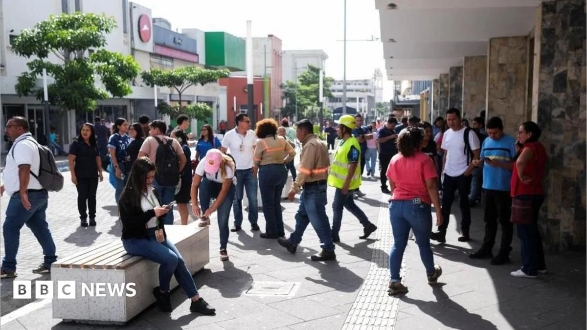
Across the border in Guatemala and El Salvador, the tremors were also strongly felt, shaking buildings and prompting immediate evacuations. Reuters news agency reported scenes of residents running from their homes in panic, highlighting the instinctive human reaction to such powerful seismic events.
Guatemala’s President Bernardo Arévalo quickly mobilized the country’s emergency management agency in response not only to the main tremor but specifically mentioned a magnitude 5.6 aftershock with its epicenter in Quetzaltenango, a densely populated area. President Arévalo took to X (formerly Twitter) to address his nation, stating, "I call on the population to remain calm and to follow the recommendations," underscoring the critical role of official communication during crises to prevent misinformation and panic.
The U.S. National Oceanic and Atmospheric Administration (NOAA), which operates the tsunami warning center, provided a broader regional forecast. While the immediate threat to Mexico and Guatemala was eventually lifted, NOAA predicted waves of less than 0.3 meters (one foot) above tide level along the coasts of several other Central and South American nations, including El Salvador, Colombia, Costa Rica, Ecuador, Nicaragua, Panama, Peru, and Honduras. This wider advisory reflects the potential for tsunamis to travel vast distances, albeit with diminishing energy. NOAA’s guidance for these areas was clear: "Persons caught in the water of a tsunami may drown, be crushed by debris in the water, or be swept out to sea." They further advised that government agencies in these threatened coastal areas should instruct populations at risk and that individuals should "stay alert for information and follow instructions from national and local authorities." This reiterates the universal message of preparedness and adherence to official guidance in tsunami-prone regions.
Broader Impact and Implications for Regional Preparedness
While the immediate outcome of this powerful earthquake was remarkably positive in terms of human safety and structural integrity, its occurrence carries broader implications for regional preparedness, economic resilience, and societal awareness in Central America.
Economic Implications: The absence of significant damage or fatalities is a substantial economic relief for the affected nations, particularly Mexico and Guatemala. Major earthquakes, especially those coupled with destructive tsunamis, can decimate coastal infrastructure, halt tourism (a vital industry for many regions), disrupt shipping, and damage fishing fleets. Had this magnitude 7.3 event occurred closer to major urban centers or generated a more substantial tsunami, the economic fallout could have been catastrophic, requiring extensive reconstruction efforts and long-term recovery programs. The quick resolution of the tsunami threat allowed for a rapid return to normalcy, minimizing economic disruption to businesses and daily life.
Social Impact and Psychological Resilience: Earthquakes, regardless of their ultimate destructive power, are profoundly unsettling events. The widespread shaking and the ensuing tsunami warning inevitably caused fear, anxiety, and disruption to daily routines. Evacuations, even if brief, are stressful experiences. However, the relatively calm and organized response, particularly in the absence of severe damage, speaks to a level of public awareness and preparedness. Continued public education on earthquake safety, tsunami evacuation routes, and emergency protocols is crucial for fostering psychological resilience and ensuring that communities can respond effectively and calmly when future events occur.
Environmental Considerations: While not immediately apparent, strong offshore earthquakes can have subtle environmental impacts. The displacement of the seafloor can sometimes lead to localized underwater landslides, affecting marine ecosystems. Tsunami waves, even small ones, can cause coastal erosion, disrupt delicate intertidal zones, and potentially impact coastal infrastructure like ports and jetties over time. Monitoring these potential long-term environmental changes is part of a comprehensive disaster management strategy.
Reinforcing Regional Cooperation and Early Warning Systems: This event underscored the indispensable value of sophisticated seismic monitoring networks and multinational tsunami warning systems. The ability of agencies like the USGS, US Tsunami Warning System, and NOAA to rapidly detect, analyze, and disseminate warnings across national borders is paramount. The collaborative efforts between Mexico, Guatemala, El Salvador, and other regional partners in emergency response and information sharing are vital. Investing in advanced monitoring equipment, improving communication infrastructure, and conducting regular cross-border emergency drills are critical steps to enhance regional resilience against future seismic and tsunamigenic threats. The widespread nature of the NOAA advisory to countries as far south as Peru highlights the interconnectedness of the Pacific basin in terms of tsunami risk.
Long-term Preparedness and Infrastructure Resilience: The fact that structures largely withstood a 7.3 magnitude tremor suggests that building codes and construction practices in the region, particularly in Mexico, may be robust enough to withstand significant seismic forces. However, continued adherence to and enforcement of stringent building codes, especially in rapidly developing coastal areas, remains crucial. Public education campaigns, regular evacuation drills, and the maintenance of clear emergency communication channels are ongoing requirements for communities living in this seismically active zone.
In conclusion, the magnitude 7.3 earthquake off southern Mexico served as a powerful reminder of the Earth’s dynamic nature and the ever-present geological risks in the Pacific Ring of Fire. While the immediate impact was mercifully minimal, the event highlighted the critical importance of advanced early warning systems, coordinated regional responses, robust infrastructure, and a well-informed populace in mitigating the potential for disaster. The rapid assessment, timely warnings, and effective public advisories were key factors in ensuring that a powerful natural phenomenon passed with minimal disruption to human life, offering valuable lessons for future preparedness efforts across the region.