


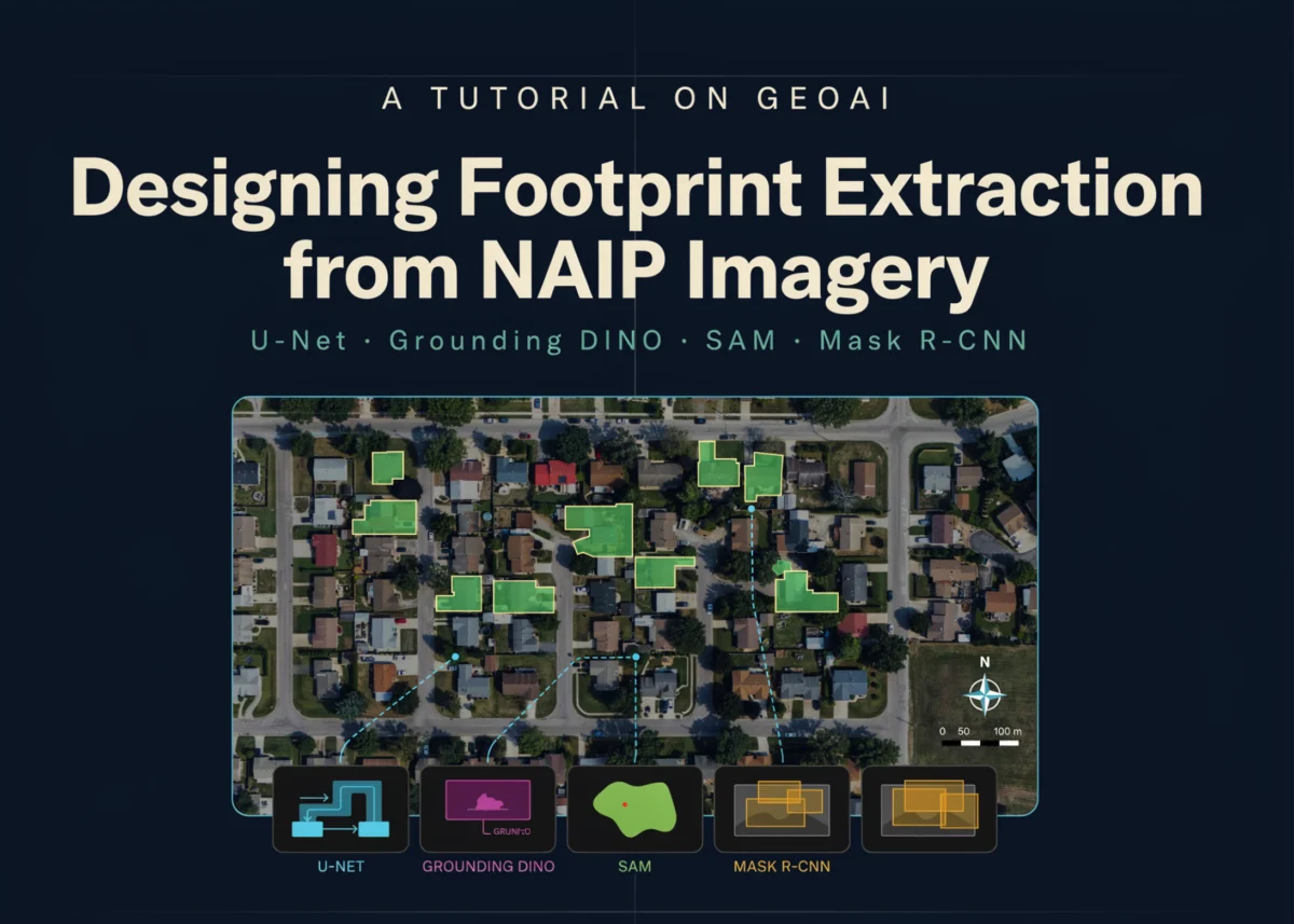
The emergence of sophisticated Geospatial Artificial Intelligence (GeoAI) frameworks has revolutionized the way urban planners, environmental scientists, and government agencies interpret Earth observation data, transitioning from manual digitization to automated, high-precision extraction of infrastructure. A newly detailed technical workflow utilizing the open-source geoai library provides a comprehensive blueprint for extracting building footprints from high-resolution National Agriculture Imagery Program (NAIP) aerial imagery. This end-to-end pipeline integrates deep learning architectures, such as U-Net and ResNet-34, with cutting-edge foundation models like Grounding DINO and the Segment Anything Model (SAM) to transform raw pixels into analysis-ready vector geometries. By bridging the gap between raw spectral data and structured Geographic Information System (GIS) datasets, this workflow addresses a critical need for scalable, accurate, and cost-effective mapping solutions in an era of rapid urbanization and climate instability.
The Evolution of Building Footprint Extraction
Building footprint extraction has historically been one of the most labor-intensive tasks in the geospatial industry. Traditionally, cartographers relied on manual heads-up digitizing, a process prone to human error and significant time lags. The introduction of NAIP imagery—administered by the USDA’s Farm Service Agency—provided a consistent, high-resolution source of aerial photography, typically at 0.6-meter to 1-meter ground sample distance. However, the sheer volume of this data, covering the continental United States, necessitated an automated approach.
The shift toward GeoAI represents a paradigm change. By utilizing convolutional neural networks (CNNs) and transformer-based models, researchers can now process terabytes of imagery in a fraction of the time required for manual entry. The current workflow leverages these advancements, offering a modular approach that accommodates both custom-trained models and zero-shot foundation models. This flexibility is vital for organizations that may lack the massive labeled datasets required for traditional supervised learning.
Technical Framework and Project Chronology
The development of the building footprint extraction pipeline follows a rigorous 12-step progression, ensuring data integrity from initial environment configuration to final vector regularization.
Phase I: Environment and Data Acquisition
The workflow begins with the orchestration of a specialized geospatial deep learning environment. This involves the installation of the geoai-py ecosystem, segmentation-models-pytorch, and buildingregulariser libraries. A critical component of this phase is the verification of hardware acceleration; the use of NVIDIA T4 GPUs or higher is recommended to manage the computational load of training deep residual networks.
Following setup, the process moves to data ingestion. The workflow utilizes NAIP RGB imagery paired with GeoJSON vector labels. Unlike standard computer vision tasks, geospatial data requires strict adherence to Coordinate Reference Systems (CRS). The pipeline includes automated checks to ensure that raster imagery and vector labels are spatially aligned, preventing the "offset" errors that frequently plague automated mapping projects.
Phase II: Preprocessing and Model Training
Before a model can learn, the high-resolution "mega-rasters" must be decomposed into manageable units. The workflow implements a sliding-window approach to generate 512×512 pixel image chips and corresponding binary segmentation masks. This step is enhanced by a "stride" parameter, which creates overlapping tiles to ensure that buildings at the edges of a chip are fully captured in at least one training sample.
For the core architecture, the pipeline employs a U-Net model with a ResNet-34 encoder. ResNet-34, pretrained on the ImageNet dataset, provides a robust feature extraction backbone, allowing the model to recognize geometric patterns—such as 90-degree corners and rectangular rooflines—with minimal training iterations. The training phase incorporates validation splitting and early stopping mechanisms to prevent overfitting, a common challenge when dealing with the repetitive textures found in suburban and rural aerial imagery.
Phase III: Inference and Post-Processing
Once trained, the model is applied to unseen "test" scenes. The output is a probability raster where each pixel is assigned a value representing the likelihood of it belonging to a building. However, raw neural network outputs are often "noisy," characterized by "salt-and-pepper" artifacts or irregular edges.
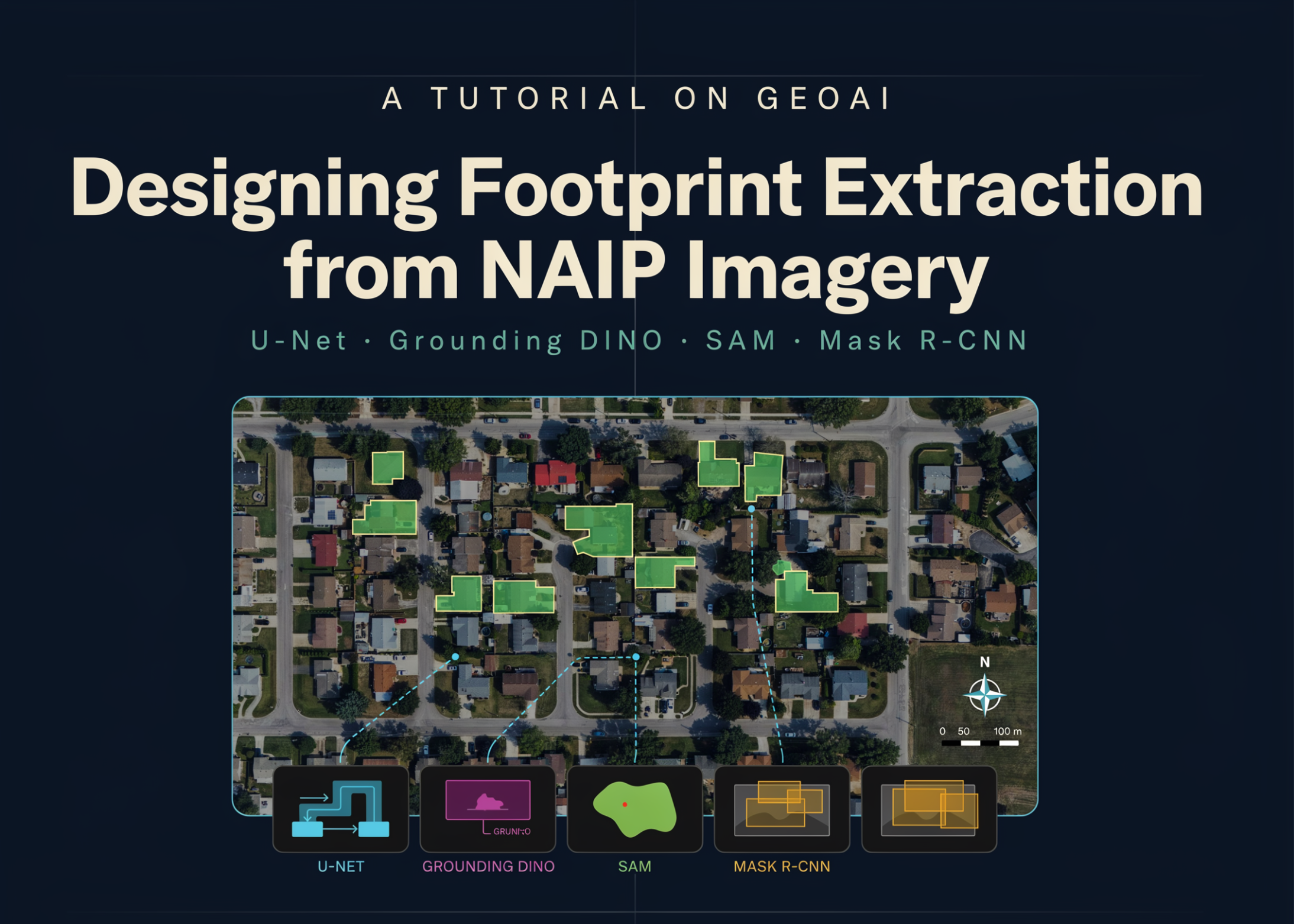
To resolve this, the workflow introduces a sophisticated post-processing suite. First, a region-grouping algorithm filters out small, disconnected pixel clusters that are unlikely to be buildings. Second, the raster-to-vector conversion process is followed by orthogonalization and regularization. This ensures that the final building footprints have the crisp, 90-degree angles characteristic of human-made structures, making them compatible with professional CAD and GIS software.
Comparative Analysis of Segmentation Methodologies
A significant contribution of this workflow is its comparative analysis of different AI paradigms. The pipeline demonstrates three distinct approaches to building extraction:
- Supervised Semantic Segmentation (U-Net): This approach is highly efficient for large-scale mapping where specific regional building styles are known. It excels at identifying the "presence" of buildings across vast landscapes but can struggle to separate individual houses in dense urban clusters.
- Zero-Shot Foundation Models (Grounding DINO + SAM): By using text prompts like "rooftop" or "house," the workflow leverages Grounding DINO for object detection and SAM for precise mask generation. This "zero-shot" capability allows for immediate extraction without any prior training, representing a breakthrough for rapid disaster response mapping.
- Instance Segmentation (Mask R-CNN): Unlike U-Net, which treats all building pixels as a single class, Mask R-CNN identifies each building as a unique entity. The workflow notes that while U-Net might merge adjacent roofs, Mask R-CNN effectively splits them, providing a more accurate count of individual structures for census or tax assessment purposes.
Supporting Data and Performance Metrics
The efficacy of the GeoAI pipeline is validated through quantitative metrics, primarily Intersection over Union (IoU) and the F1-score. In recent benchmarks, models trained using this specific ResNet-34 backbone have achieved building-class IoU scores exceeding 0.75 on standardized NAIP datasets. While background pixels (trees, roads, grass) often show higher accuracy due to their prevalence, the "Building-class IoU" is the primary indicator of a model’s utility for urban mapping.
Furthermore, the integration of geometric property calculations provides an additional layer of data. The workflow automatically calculates area, perimeter, solidity, and orientation for every extracted footprint. For example, in a sample test scene, the pipeline can identify whether a building’s orientation aligns with local zoning laws or solar potential, adding a layer of "intelligence" to the raw geometry.
Integration with Microsoft Planetary Computer and Overture Maps
To demonstrate real-world scalability, the workflow extends its reach to the Microsoft Planetary Computer (MPC) and Overture Maps. MPC provides a SpatioTemporal Asset Catalog (STAC) API, allowing the pipeline to programmatically query and download NAIP imagery for any coordinate in the United States.
Simultaneously, the workflow incorporates building labels from Overture Maps—a collaborative effort by Meta, Amazon, Microsoft, and TomTom to create a high-quality, open-source map of the world. By combining MPC’s imagery with Overture’s labels, the pipeline can be "retrained" on any specific geographic area, from the dense high-rises of Manhattan to the sprawling suburbs of the Sun Belt, without the user ever having to manually draw a single polygon.
Broader Impact and Industry Implications
The implications of democratizing such high-powered GeoAI workflows are profound. In the public sector, local governments can use these tools to update property tax rolls and monitor unauthorized construction in real-time. In the realm of environmental conservation, the ability to accurately map structures in high-risk zones—such as floodplains or wildfire-prone wildland-urban interfaces—is essential for risk modeling and emergency evacuation planning.
Industry experts suggest that the next frontier for this technology is "change detection." By running the pipeline on NAIP imagery from different years (e.g., 2019 vs. 2023), organizations can automatically detect new construction, demolitions, or significant structural modifications. This temporal analysis is a cornerstone of the "Digital Twin" concept, where a virtual representation of a city is kept in constant sync with its physical counterpart.
Moreover, the modular nature of the geoai library allows for the integration of other foundation models, such as NASA and IBM’s Prithvi, which are trained on multi-spectral satellite data. This suggests a future where building extraction is just one component of a holistic "Land Cover" analysis, identifying not just buildings, but the health of the surrounding vegetation and the permeability of the ground surface.
Conclusion
The GeoAI workflow for building footprint extraction from NAIP imagery represents a successful fusion of traditional geospatial science and modern computer vision. By providing a clear, reproducible path from raw imagery to regularized vector data, it empowers a wide range of stakeholders to conduct large-scale spatial analysis with unprecedented precision. As foundation models continue to evolve and global imagery becomes more accessible through platforms like Microsoft Planetary Computer, the barriers to entry for GeoAI will continue to fall, paving the way for more resilient and data-driven urban environments. The transition from pixels to polygons is no longer a bottleneck; it is a bridge to deeper geographic understanding.